I just subscribed to CalTopo! If you are an outdoorsy type needing maps, I suggest you do as well to support this awesome service.
Showing posts with label outdoor. Show all posts
Showing posts with label outdoor. Show all posts
Saturday, November 07, 2015

Tuesday, May 21, 2013
Bengt's Birthday Weekend Activities
- With Bengt's 13th birthday, the teenagers have evened the odds in the Osten household.
- Bengt and I went fishing aboard the Chubasco II. The trip was just off shore in the local kelp beds. Fishing was pretty good. Bengt got a nice sized oceanic whitefish and I pulled in a monster 31 lb. halibut. That easily won the trip jackpot! Thanks to the crew for a good time.


Tuesday, June 14, 2011
Southwest National Parks Tour
This summer, Jyoti planned a 19 day tour of the western National Parks. This is that tale of that journey...
Day 0 - 5/31/2011 – Since dogs are not welcome in most National Parks, we drove up to my parents in Orange County to drop off Sophie. This will also shave at least an hour off of our travel time tomorrow. Also, my parents just got back from Europe (Greek islands cruise and Venice) so we wanted to hear about that.
Day 1 – 6/1/2011 – Woke up, ate breakfast and hit the road for our first stop, Las Vegas. We thought it would be fun to stop in Vegas and see the city. I haven’t been there in years and haven’t experienced the latest hotels. On the whole we were very disappointed. The strip is almost un-walkable now. Many intersections have pedestrian bridges but they are offset from the street so you can’t see much from them. The strip has lost its charm. Monstrosities like Planet Hollywood are more reminiscent of Tijuana than the Rat Pack glory days of Vegas. It is nigh impossible to see the strip as a whole. The hotels are so up front and obtrusive, the anticipation you used to get as you approached the colonnade at Caesar’s Palace can no longer be felt. The street engineering and total lack of traffic signage is geared towards trapping unknowing tourists into strip for eternity.
We stayed at Excalibur due to a very good rate from Priceline. I do not recommend it. This hotel is very dated and is due for a Sands-like implosion. The room was clean and comfortable, but the entire building is worn out. We couldn’t wait to fall asleep, wake up and get to our next stop, Zion National Park.
Day 2 – 6/2/2011 – After making a hasty getaway from the clutches of Las Vegas, we headed up I-15 through vast deserts. You know you are in the great Southwestern open spaces when your navigation system displays simply a straight line.
It was just a 4 hour drive to Zion but we stopped in La Verkin, UT to pick up groceries and gas up. We are getting about 21 mpg with the car top carrier fully loaded.
We made it to Zion and checked into our campground. The camps were supposedly booked solid but we saw several unused sites. I am not sure when the open those up to those without reservations. Our camp was D19 in the Watchman Campground. It is a very nice camp within a grove of cottonwoods, which are seeding right now so the ground is covered with “cotton.”
It seems the National Park Service has either avoided the latest federal budget cuts or is the recipient of a large portion of the “stimulus” money as the facilities are in tip-top shape. The campgrounds are very tidy, the bathrooms look new and the visitor center is extremely nice. They also have a very efficient bus system that saves everyone from having to drive up and down the canyon.
Our first stop for the day was at the upper portion of the canyon. We did the 2 mile Riverside hike but could not go into the Narrows due to the amount of water in the still-raging Virgin River.

We then headed back to camp and into town for dinner. Springdale, Utah is a very quaint little town with many upscale-looking shops, inns and restaurants. We had a good referral for the Whiptail Grill, located in an old gas station. I ordered a Zion Brewing Company IPA. Although not as hoppy as a West Coast-style IPA, it was delicious nonetheless. The food was slow in coming, but it was excellent. Jo had some of the best fish tacos ever. I had a wonderfully spicy Green Chile Burger. We finished it off with a Peanut Butter Chocolate Habanero Crème Brule! The Whiptail Grill is on the pricy side, but it well worth it if you want gourmet food after your hard day hiking Zion.
Day 3 – 6/3/2011 – We checked in early last night and slept in late. I woke up and prepared my usual breakfast: spinach, chicken sausage and eggs. After eating, we headed into town in search of Wi-Fi. We found it at the uber-friendly Café de Soleil. The people at Whiptail recommended the coffee there and we were not disappointed. The Americano I got had four shots of excellent espresso.
Our original plan was to drive over to Bryce Canyon, but after checking the maps, we decided it wasn’t worth the 2 hour drive each way. We headed back into Zion. Our morning hike was the Lower and Upper Emerald Pools. We came back via the Kayenta Trail to the Grotto. After lunch we went to the museum.
We had dinner at Blondie’s Diner. This diner is built into an old house from the 1920’s. The food is good and bit less expensive than other options in Springdale. Blondie’s homemade pie was excellent.
Day 4 – 6/4/2011 – Today was a big day as Bengt decided he wanted to try the Angel’s Landing Trail. This trail is a very treacherous adventure! We started in the morning which was vital to avoiding the sun on the way up. The first half of the trail is a very steep series of switchbacks carved and molded into the side of the cliff face. We then entered a canyon that was fairly flat to the end. Then was Wallace’s Wiggles, a sequence of very short but very steep switchbacks leading up to Scout’s Landing. Three of us only went a little bit further up the way to Angel’s Point, but Jaya decided to tackle it alone! That brave girl made it to the very top. We made it down in time for a late lunch at the Zion Lodge. Final tally: 5.4 miles, 1488 feet elevation gain, 3.5 hours.

If you look hard, you can see Jaya in the red circle (this was coming down after she made it to the top).

After lunch we went to Weeping Rock for a quick, but steep trail to a hanging garden.
We then said goodbye to Zion and heading off to Grand Canyon National Park North Rim, just 3 short hours away.
After stopping in Kanab for groceries, we got into Grand Canyon NP pretty late. We had a quick bite at the lodge deli (I recommend the chili) and set up camp. We were pooped from the day’s hikes so it was an early bedtime.

Day 5 – 6/5/2011 – A morning campfire lead to a leisurely camper pie breakfast. We then headed to the general store for some morning coffee and email checking. The staff at the store is extremely friendly! Our first hike was Bridle Trail down to the historic and majestic Grand Canyon Lodge. The lobby has panoramic views of the canyon and the south rim. We then headed down the short Bright Angel Point trail to the wide open views at the point. We then headed back to camp for lunch, laundry and relaxation. We hung out on the store porch for a while in the nice shade.
Day 6 – 6/6/2011 – Most of the day was spent driving over to Walhalla Plateau. We stopped for the quick but nice Cliff Springs trail. We then headed to Cape Royal for the incredible views. This is the only spot on the North Rim where you can see the river. We stopped at the Walhalla Glades ruins on the way back.
Bengt discovered a new favorite animal, the Kaibab squirrel, a cute little guy with a black body, white tail and tufted ears.


Day 7 – 6/7/2011 – We ate breakfast and headed out early for the long drive to Mesa Verde. This drive was along some of most desolate desert country I have seen.
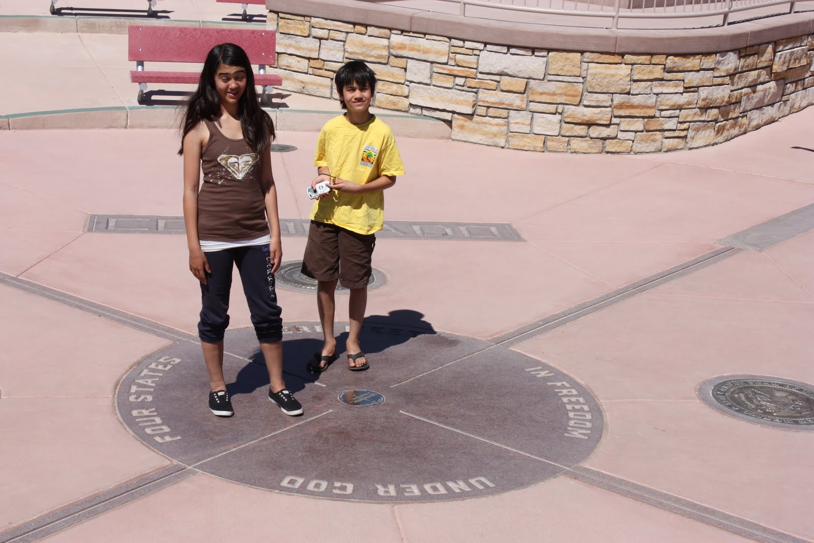
We stopped at Four Corners for photos and delicious Navajo fry bread with honey.

Our first night at Mesa Verde was at the Mesa Verde Lodge. The Lodge is located near the north end of the park and our room had a glorious view of the park down to the Ute reservation beyond. Unfortunately, the views here and at Grand Canyon were somewhat obscured due to the massive wildfires in Arizona.
Our original plan was to head next to Grand Teton NP and then Yellowstone. However, the weather at Yellowstone was still cold and the forecast called for snow and rain. We made the tough decision to cut our trip short. We spent the evening at the lodge lounge re-planning the trip.

Day 8 – 6/8/2011 – Thanks to advice from a helpful ranger at Grand Canyon, we got tickets for the first two dwelling tours to avoid the sun. The first tour was of Cliff Palace, the largest dwelling. This tour provided the least amount of access to the ruins, it essentially passed along the front. After lunch, we toured the east-facing Balcony House. This tour was by far the most adventurous with a 30-foot ladder climb and a treacherous rock climb. But the dwelling tour was awesome as you walked among the ruins. Between the tours we visited the excellent Chapin Mesa Archaeological Museum. We also took the self-guided Spruce Tree House tour. Spruce Tree House has a reconstructed kiva that you can go in.
In the evening, we set up camp in the Morefield Campground.

Day 9 – 6/9/2011 – This day was spent on Wetherill Mesa. This mesa has a tram that takes you the various sites. We toured the impressive Long House and smallish Step House. By coincidence, we had the same ranger on all our tours. Thanks for the tours and good luck, Ranger Jess. We also did the walking tour of the Badger Community which spanned the entire 700 year inhabitation period of the mesa.
One of many highlights of Mesa Verde was the excellent Far View Terrace restaurant which had great food at great prices; the staff was very friendly as well.
Day 10 – 6/10/2011 – Today was going to be a wildcard. We didn’t have a specific plan of what to see other than Arches NP. We made it to Moab around noon and had lunch at the excellent Eklectica. The got desert at the Action Shots ice cream shop across the street and the man there said we should go to Canyonlands NP, something we were not planning.
We drove into Arches and made our typical first stop at the visitor center. Arches has a new and very nice center. We made a point to learn about cryptobiotic soil. After the center, we made the drive through the park. We stopped at various points to see the amazing features such as Balanced Rock, North Window Arch and Turret Arch. It was brutally hot so we didn’t do the hike to Delicate Arch, but took the short path to the viewpoint.


We decided we had seen the bulk of Arches and headed over to nearby Canyonlands. It was a long drive to the visitor center, but we were amazed at the scenery. After a quick stop at the small visitor center, we drove down to Grand View Point. The vista from there was amazing, among the best we have seen. One the way back out, we did the short but impressive Mesa Arch trail. We didn’t have much time to spend in Canyonlands, but we will be back at some point. There is much to do and see in this lesser known park.


We spent the evening driving to Richfield, UT where we had a hotel reservation. The drive from Green River, UT and Richfield was through some territory where I could not see evidence of people for miles. It was beautiful country.
Day 11 – 6/11/2011 – Today was another wildcard since we didn’t have a place to stay for the night. Our plan was to camp at Bryce Canyon NP. We drove down the picturesque I-28 along the flooded Sevier River to Bryce. We hit the visitor center and then checked out the campgrounds. We didn’t get a site yet and headed over to the lodge for lunch. The lodge was very nice and lunch was good. We then head to Sunrise Point for the “best 3.5 mile hike in the world.” If this hike isn’t the best, it is close to it. Starting at the top of the rim, you can see the hoodoos. They are even more impressive as you descend into the canyon along the Queen’s Garden trail. We went up the Navajo Loop trail to get back to the top. We then drove down the road to the Far View Lookout. Along the road we saw two herds of pronghorns which was pretty cool. We decided that we had seen almost all there was to see at Bryce and headed out.


Day 12 – 6/12/2011 – The long drive home from St. George to mom’s. We stopped at Peggy Sue’s Nifty 50’s Diner for lunch.
Day 0 - 5/31/2011 – Since dogs are not welcome in most National Parks, we drove up to my parents in Orange County to drop off Sophie. This will also shave at least an hour off of our travel time tomorrow. Also, my parents just got back from Europe (Greek islands cruise and Venice) so we wanted to hear about that.
Day 1 – 6/1/2011 – Woke up, ate breakfast and hit the road for our first stop, Las Vegas. We thought it would be fun to stop in Vegas and see the city. I haven’t been there in years and haven’t experienced the latest hotels. On the whole we were very disappointed. The strip is almost un-walkable now. Many intersections have pedestrian bridges but they are offset from the street so you can’t see much from them. The strip has lost its charm. Monstrosities like Planet Hollywood are more reminiscent of Tijuana than the Rat Pack glory days of Vegas. It is nigh impossible to see the strip as a whole. The hotels are so up front and obtrusive, the anticipation you used to get as you approached the colonnade at Caesar’s Palace can no longer be felt. The street engineering and total lack of traffic signage is geared towards trapping unknowing tourists into strip for eternity.
We stayed at Excalibur due to a very good rate from Priceline. I do not recommend it. This hotel is very dated and is due for a Sands-like implosion. The room was clean and comfortable, but the entire building is worn out. We couldn’t wait to fall asleep, wake up and get to our next stop, Zion National Park.
Day 2 – 6/2/2011 – After making a hasty getaway from the clutches of Las Vegas, we headed up I-15 through vast deserts. You know you are in the great Southwestern open spaces when your navigation system displays simply a straight line.
It was just a 4 hour drive to Zion but we stopped in La Verkin, UT to pick up groceries and gas up. We are getting about 21 mpg with the car top carrier fully loaded.
We made it to Zion and checked into our campground. The camps were supposedly booked solid but we saw several unused sites. I am not sure when the open those up to those without reservations. Our camp was D19 in the Watchman Campground. It is a very nice camp within a grove of cottonwoods, which are seeding right now so the ground is covered with “cotton.”
It seems the National Park Service has either avoided the latest federal budget cuts or is the recipient of a large portion of the “stimulus” money as the facilities are in tip-top shape. The campgrounds are very tidy, the bathrooms look new and the visitor center is extremely nice. They also have a very efficient bus system that saves everyone from having to drive up and down the canyon.
Our first stop for the day was at the upper portion of the canyon. We did the 2 mile Riverside hike but could not go into the Narrows due to the amount of water in the still-raging Virgin River.

We then headed back to camp and into town for dinner. Springdale, Utah is a very quaint little town with many upscale-looking shops, inns and restaurants. We had a good referral for the Whiptail Grill, located in an old gas station. I ordered a Zion Brewing Company IPA. Although not as hoppy as a West Coast-style IPA, it was delicious nonetheless. The food was slow in coming, but it was excellent. Jo had some of the best fish tacos ever. I had a wonderfully spicy Green Chile Burger. We finished it off with a Peanut Butter Chocolate Habanero Crème Brule! The Whiptail Grill is on the pricy side, but it well worth it if you want gourmet food after your hard day hiking Zion.
Day 3 – 6/3/2011 – We checked in early last night and slept in late. I woke up and prepared my usual breakfast: spinach, chicken sausage and eggs. After eating, we headed into town in search of Wi-Fi. We found it at the uber-friendly Café de Soleil. The people at Whiptail recommended the coffee there and we were not disappointed. The Americano I got had four shots of excellent espresso.
Our original plan was to drive over to Bryce Canyon, but after checking the maps, we decided it wasn’t worth the 2 hour drive each way. We headed back into Zion. Our morning hike was the Lower and Upper Emerald Pools. We came back via the Kayenta Trail to the Grotto. After lunch we went to the museum.
We had dinner at Blondie’s Diner. This diner is built into an old house from the 1920’s. The food is good and bit less expensive than other options in Springdale. Blondie’s homemade pie was excellent.
Day 4 – 6/4/2011 – Today was a big day as Bengt decided he wanted to try the Angel’s Landing Trail. This trail is a very treacherous adventure! We started in the morning which was vital to avoiding the sun on the way up. The first half of the trail is a very steep series of switchbacks carved and molded into the side of the cliff face. We then entered a canyon that was fairly flat to the end. Then was Wallace’s Wiggles, a sequence of very short but very steep switchbacks leading up to Scout’s Landing. Three of us only went a little bit further up the way to Angel’s Point, but Jaya decided to tackle it alone! That brave girl made it to the very top. We made it down in time for a late lunch at the Zion Lodge. Final tally: 5.4 miles, 1488 feet elevation gain, 3.5 hours.

If you look hard, you can see Jaya in the red circle (this was coming down after she made it to the top).

After lunch we went to Weeping Rock for a quick, but steep trail to a hanging garden.
We then said goodbye to Zion and heading off to Grand Canyon National Park North Rim, just 3 short hours away.
After stopping in Kanab for groceries, we got into Grand Canyon NP pretty late. We had a quick bite at the lodge deli (I recommend the chili) and set up camp. We were pooped from the day’s hikes so it was an early bedtime.

Day 5 – 6/5/2011 – A morning campfire lead to a leisurely camper pie breakfast. We then headed to the general store for some morning coffee and email checking. The staff at the store is extremely friendly! Our first hike was Bridle Trail down to the historic and majestic Grand Canyon Lodge. The lobby has panoramic views of the canyon and the south rim. We then headed down the short Bright Angel Point trail to the wide open views at the point. We then headed back to camp for lunch, laundry and relaxation. We hung out on the store porch for a while in the nice shade.
Day 6 – 6/6/2011 – Most of the day was spent driving over to Walhalla Plateau. We stopped for the quick but nice Cliff Springs trail. We then headed to Cape Royal for the incredible views. This is the only spot on the North Rim where you can see the river. We stopped at the Walhalla Glades ruins on the way back.
Bengt discovered a new favorite animal, the Kaibab squirrel, a cute little guy with a black body, white tail and tufted ears.


Day 7 – 6/7/2011 – We ate breakfast and headed out early for the long drive to Mesa Verde. This drive was along some of most desolate desert country I have seen.
We stopped at Four Corners for photos and delicious Navajo fry bread with honey.
Our first night at Mesa Verde was at the Mesa Verde Lodge. The Lodge is located near the north end of the park and our room had a glorious view of the park down to the Ute reservation beyond. Unfortunately, the views here and at Grand Canyon were somewhat obscured due to the massive wildfires in Arizona.
Our original plan was to head next to Grand Teton NP and then Yellowstone. However, the weather at Yellowstone was still cold and the forecast called for snow and rain. We made the tough decision to cut our trip short. We spent the evening at the lodge lounge re-planning the trip.

Day 8 – 6/8/2011 – Thanks to advice from a helpful ranger at Grand Canyon, we got tickets for the first two dwelling tours to avoid the sun. The first tour was of Cliff Palace, the largest dwelling. This tour provided the least amount of access to the ruins, it essentially passed along the front. After lunch, we toured the east-facing Balcony House. This tour was by far the most adventurous with a 30-foot ladder climb and a treacherous rock climb. But the dwelling tour was awesome as you walked among the ruins. Between the tours we visited the excellent Chapin Mesa Archaeological Museum. We also took the self-guided Spruce Tree House tour. Spruce Tree House has a reconstructed kiva that you can go in.
In the evening, we set up camp in the Morefield Campground.

Day 9 – 6/9/2011 – This day was spent on Wetherill Mesa. This mesa has a tram that takes you the various sites. We toured the impressive Long House and smallish Step House. By coincidence, we had the same ranger on all our tours. Thanks for the tours and good luck, Ranger Jess. We also did the walking tour of the Badger Community which spanned the entire 700 year inhabitation period of the mesa.
One of many highlights of Mesa Verde was the excellent Far View Terrace restaurant which had great food at great prices; the staff was very friendly as well.
Day 10 – 6/10/2011 – Today was going to be a wildcard. We didn’t have a specific plan of what to see other than Arches NP. We made it to Moab around noon and had lunch at the excellent Eklectica. The got desert at the Action Shots ice cream shop across the street and the man there said we should go to Canyonlands NP, something we were not planning.
We drove into Arches and made our typical first stop at the visitor center. Arches has a new and very nice center. We made a point to learn about cryptobiotic soil. After the center, we made the drive through the park. We stopped at various points to see the amazing features such as Balanced Rock, North Window Arch and Turret Arch. It was brutally hot so we didn’t do the hike to Delicate Arch, but took the short path to the viewpoint.


We decided we had seen the bulk of Arches and headed over to nearby Canyonlands. It was a long drive to the visitor center, but we were amazed at the scenery. After a quick stop at the small visitor center, we drove down to Grand View Point. The vista from there was amazing, among the best we have seen. One the way back out, we did the short but impressive Mesa Arch trail. We didn’t have much time to spend in Canyonlands, but we will be back at some point. There is much to do and see in this lesser known park.


We spent the evening driving to Richfield, UT where we had a hotel reservation. The drive from Green River, UT and Richfield was through some territory where I could not see evidence of people for miles. It was beautiful country.
Day 11 – 6/11/2011 – Today was another wildcard since we didn’t have a place to stay for the night. Our plan was to camp at Bryce Canyon NP. We drove down the picturesque I-28 along the flooded Sevier River to Bryce. We hit the visitor center and then checked out the campgrounds. We didn’t get a site yet and headed over to the lodge for lunch. The lodge was very nice and lunch was good. We then head to Sunrise Point for the “best 3.5 mile hike in the world.” If this hike isn’t the best, it is close to it. Starting at the top of the rim, you can see the hoodoos. They are even more impressive as you descend into the canyon along the Queen’s Garden trail. We went up the Navajo Loop trail to get back to the top. We then drove down the road to the Far View Lookout. Along the road we saw two herds of pronghorns which was pretty cool. We decided that we had seen almost all there was to see at Bryce and headed out.


Day 12 – 6/12/2011 – The long drive home from St. George to mom’s. We stopped at Peggy Sue’s Nifty 50’s Diner for lunch.
Monday, May 30, 2011
Camping in Cuyamaca
We finally made a family camp this weekend at the Green Valley Campground in Cuyamaca Rancho State Park. We had a great time with 8 other families!
* Hiked to the Green Vally falls on the Sweetwater river. These are probably the most accessible falls in the county and are a little-known gem.
* Hiked to the airplane monument. This was a pretty touch hike due to the elevation climb (900' in less than 2 miles) and the very rocky and broken terrain. It was worth it though.
* The rain started early Monday morning and didn't really let up. I was up to make some coffee and breakfast, then everyone packed and heading out. The Green Monster tent held up well except for the windows flaps which blew up. This exposed the screen windows so some rain could sneak in.
* Tried out our new soft car top carrier. It worked great for carrying the tent and other bulky items. A couple of small modifications to the configuration and it will be perfect. It held up nicely in the rain as well.
* Hiked to the Green Vally falls on the Sweetwater river. These are probably the most accessible falls in the county and are a little-known gem.
* Hiked to the airplane monument. This was a pretty touch hike due to the elevation climb (900' in less than 2 miles) and the very rocky and broken terrain. It was worth it though.

* The rain started early Monday morning and didn't really let up. I was up to make some coffee and breakfast, then everyone packed and heading out. The Green Monster tent held up well except for the windows flaps which blew up. This exposed the screen windows so some rain could sneak in.
* Tried out our new soft car top carrier. It worked great for carrying the tent and other bulky items. A couple of small modifications to the configuration and it will be perfect. It held up nicely in the rain as well.
Thursday, January 29, 2009
Tuesday, January 13, 2009
Weekend Activities
* Guides trip to Agua Caliente County Park. The weather was perfect and made for a great time at the mud caves and on the Moonlight Trail. Bengt's pinewood racer was the 3rd fastest in the tribe and he made the nation finals where he got the second round. The ranger was a bit persnickety and made us douse the campfires way too early.

* Walked dog at San Elijo Lagoon.

* Walked dog at San Elijo Lagoon.
Tuesday, October 14, 2008
Woodcutters Weekend
The kids and I have been going to Camp Marston near Julian for several years now. I always wanted my wife to go to see what all the fuss was about. It turns out that the camp has a Woodcutters Weekend that families can attend. Your family gets to stay at the camp at no charge, but in return you have to cut wood, literally. We spend 8 hours on Saturday and a few more on Sunday turning big pieces of wood into little pieces wood.
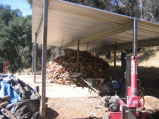
Here is a before picture of the wood pile.
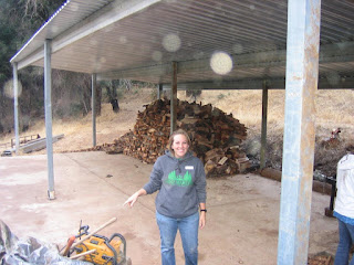
Here is the after picture of the pile; it is more impressive in person.
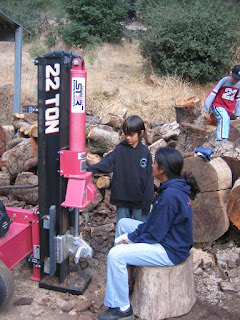
The family operating dangerous machinery
Here is a before picture of the wood pile.

Here is the after picture of the pile; it is more impressive in person.

The family operating dangerous machinery

Sunday, September 21, 2008
Weekend Activities
* Hiked Calaveras Mountain for the first time. We didn't make it to the top this time but plan to in the near future. I give the city of Carlsbad two years max before they develop this land.
Monday, September 15, 2008
Weekend Activities
* Hiked Elfin Forest Reserve for the first time.
* Adventure Guides event at Indian Hills.


* Adventure Guides event at Indian Hills.


Topos
I wanted to teach my son how to use a compass, something I learned back in my pre-GPS Boy Scout days. I started digging on USGS topographical maps. They finished with the basic mapping project in 1992 and are now in update mode. Their website doesn't give a lot of detail, but they said they will update the maps that have the greatest interest. Most of the maps around San Diego were updated in 1997 (except for the Encinitas one which was updated in 1975 making it fairly useless).
The USGS does offer free scans of the maps. Here is a good blog post on how to download the PDF's of the maps. I tried to print them out on regular paper but Adobe couldn't tile the larger image onto 8.5x11 paper, it just printed a scaled image or a single tile. The only way I could use regular sized paper was to select the area of the map I wanted and print only that selection (note that Foxit Reader does not offer this feature). It was trial and error to get the selection to fit onto one page, otherwise it would be cropped. I actually taped a couple pages together to get a usable map this way.
I still might buy software which I assume solves all these problems, but I would really like to find out if they update their maps more than the USGS or just use the same ones.
The USGS does offer free scans of the maps. Here is a good blog post on how to download the PDF's of the maps. I tried to print them out on regular paper but Adobe couldn't tile the larger image onto 8.5x11 paper, it just printed a scaled image or a single tile. The only way I could use regular sized paper was to select the area of the map I wanted and print only that selection (note that Foxit Reader does not offer this feature). It was trial and error to get the selection to fit onto one page, otherwise it would be cropped. I actually taped a couple pages together to get a usable map this way.
I still might buy software which I assume solves all these problems, but I would really like to find out if they update their maps more than the USGS or just use the same ones.
Subscribe to:
Posts (Atom)