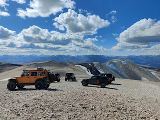
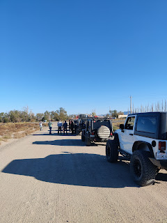
Day 1 started in Bridgeport and we headed up into the mountains. The scenery was great with lots of golden-leaved aspens. Lots of water crossings as well. The "high point" was Mt. Patterson, the highest point in California that you can drive to. We camped at Belfort ghost town where I did some exploring amongst the old mining camp.
 |
| Belfort sunset |
 |
| Line up in Bridgeport |
 |
| Lobdell Lake |
 |
| Trail up Mount Patterson |
 |
| Atop Mount Patterson |
 |
| Belfort ghost town |
 |
| Camping out of the jeep |
On Day 2 we headed downhill in great terrain and then into Sweetwater ranch. After a short drive along NV 338 we got back on trail headed west. We met up with Desert Creek and stopped for a great spot for lunch. We then headed along the creek, crossing it a few times until we reached camp at the old NF campground.
 |
| Great views |
 |
| Lunch along Desert Creek |
 |
| Camping along Desert Creek |
We started Day 3 by continuing along the creek and reaching NV 338 again. After heading south on the pavement, we turned off at East Walker River. From there we headed mostly south through the Masonic mining district until we hit the Bodie ghost town and had lunch. Our planned route from Bodie was closed so we continued south to CA 167 at Mono Lake. There was quite a bit of pavement miles back into Nevada and turned off at Rattlesnake Flat. We headed through the Excelsior Mountains and made camp in a great spot. That night was windy and a bit rainy.
 |
| Lining up near NV 338 |
 |
| Views of the Sweetwater Mountains |
 |
| Masonic mining district |
 |
| Backside of Masonic Mountain |
 |
| Bodie |
 |
| Long straight empty highway |
 |
| Camp in the Excelsior Mountains |
On Day 4, we headed south and stopped at Cow Camp and then into Tells Marsh and stopped at the old Marietta ghost town. From there we headed mainly east through the Burro reserve until we got to NV 360 we were finally aired up our tires. From there, I made the 8 hour drive home.
 |
| Heading out of the canyon |
 |
| Cow camp |
 |
| "Wild" burros |
 |
| Marietta ghost town |


